
Sources for Previous Residents at a Gloucester County Address
An address-history search leaves different kinds of evidence in different eras. A parcel and a deed describe a property transaction, while a directory, newspaper, or obituary can provide a dated household lead. Start by deciding whether the address question falls within the computer-index period, an older deed-book period, or a local-history period. That choice keeps the search from treating a present owner as a past occupant, or a historical listing as proof that someone lives there now.
| Source | Years it covers | Where held | What it can show |
|---|---|---|---|
| Recorded Land deed index | Deeds, 1959-current | Gloucester County Clerk land portal | Named parties, recording date, document reference, and legal-description lead |
| Historical deed and mortgage books | Deeds 1784-1878; mortgages 1755-1855 | County Historical Records and Record Room holdings | Earlier conveyance and tract evidence |
| Local directories | Known 1875, 1897-1904, 1913, and selected later holdings | GCHS and partner repository catalogs | Dated name, street, and sometimes occupation or business listing |
| GCHS obituary and marriage indexes | Selected death notices and marriages through 1939; added marriage coverage through 1999 | Gloucester County Historical Society | Newspaper and family-history leads to verify against the underlying source |
| Maps and surveys | 1876 atlas and selected nineteenth- and twentieth-century material | GCHS map and survey holdings | Older owner, tract, road, and building-footprint context |
Use the land index for a modern recorded transfer, historical holdings for the earlier book trail, and a directory or newspaper only when the goal is the people associated with a place at a particular time. The records may point in the same direction, but they do not prove the same thing.
Start With Gloucester County Parcel Records
For a Gloucester County address, normalize the street number, street name, unit, postal city, and legal municipality before tracing earlier occupants. The official County tax-map search links to municipal tax maps and a County Maps viewer. Use the address to capture the municipality, block, lot, map page, and owner result if the viewer displays it. Preserve a condominium qualifier or unit, because a base street address can refer to several distinct parcels.
Then compare the parcel with the official property-record-card route or NJGIN Property Explorer. The key distinction is situs versus mailing address: the situs is the physical parcel, while a tax mailing address may be elsewhere. Neither one identifies who occupied the property. Block and lot, municipality, tax year, and a legal description are the sturdier bridge from a current parcel to the prior record trail.
Note: A tax map or parcel polygon is a mapping aid, not a legal survey, so retain the source date and verify a boundary question with the proper record.
Gloucester County Past Residents in Land Index
The Gloucester County Clerk's Recorded Land portal separates Name Search, Recorder Date Search, Document Search, and Volume Search. Deeds are computer-indexed from 1959 to the present, while other document series have their own start dates. The Clerk describes county historical land records reaching back to 1686, but that does not mean every early item is in the online computer index. When the date falls before the relevant index range, use the series name and date span to ask the Record Room or the historical repository for the next access route.
The Gloucester Recorded Land portal is the source shown here, viewed August 28, 2026.
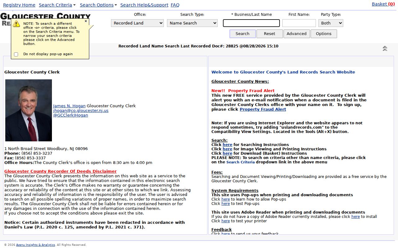
A portal tab is not a complete person search. Capture the party role as displayed, instrument type, recording date, document number or book and page, municipality or block and lot if returned, image status, and any redaction notice. The County warns that spelling variations may be needed, and a missing image may reflect a restriction rather than a missing instrument.
Trace Gloucester County Previous Residents Through Deeds
A deed chain follows ownership backward, not every person who lived at an address. Begin with the most recent reliable block-and-lot reference, then use the named parties and legal description to connect one conveyance to the preceding one. Search all relevant spelling variants because the County says recorded instruments have not been cross-indexed by party type in the land-record system since October 2016. Cross-check each transfer against the municipality and parcel description before adding it to the chain.
- Use County Maps or the property-record-card route to preserve the current municipality, block, lot, and parcel description.
- Find the most recent purchase deed using the recorded party name, document reference, date window, or volume information.
- Record grantor, grantee, instrument type, recording date, document number or book and page, and the legal-description wording.
- Search the earlier party and compare the same parcel description, rather than relying on a street number that may have changed.
- Repeat into the earlier period, then shift to deed books, microfilm, or historical holdings when the online index no longer reaches the needed date.
- Grantor and grantee
- The grantor transfers an interest in a recorded instrument; the grantee receives the stated interest.
- Chain of title
- The dated sequence of recorded transfers connected by parties and the same parcel or legal description.
- Legal description
- The tract, lot, boundary, or subdivision wording that identifies property more reliably than a street number in older records.
Search mortgage, discharge, release, lis pendens, and judgment-lien series as context where the record trail calls for it, but label each result by its instrument type. A mortgage borrower or a party to a filing is not, by itself, proof of residence at the address.
Gloucester County Road and Address Changes
When an address seems to vanish, do not assume a renumbering or a move. Research did not locate an official countywide renumbering or annexation chronology. Compare the old and current directory forms, tax-map editions, deed legal descriptions, historic maps, and municipal road records instead. A rural route, an old township name, a changed number, or a boundary change can explain why the same place is difficult to find under a modern address.
The County's historical holdings include road petitions from 1814-1902, road commissioners' reports from 1819-1913, road records from 1852-1900, and road surveys from 1801-1832 and 1833-1920. These materials may identify road names, adjoining owners, tracts, bridges, vacations, or public access. They are useful evidence for a road history, but a petition signer is not automatically a confirmed past resident.
Gloucester County Atlas and Survey Evidence
The 1876 Everts & Stewart Atlas of Salem & Gloucester Counties can bridge a modern parcel to an older property-owner name or tract sketch. GCHS also describes private property surveys with adjacent properties, waterways, schools, churches, landmarks, and building footprints. Ask whether a survey covers the tract, what source date it represents, and whether the Every-Name or Place index points to it. These are strong leads for a house-history trail when a later street address did not yet exist.
The atlas is not a substitute for a deed chain. Pair the map with a legal description, later street map, road survey, or recorded transfer. The historical directory collections themselves are described on the Gloucester County city directories page, which is the better place to verify a specific volume, reel, or city-directory entry.
Gloucester County Previous Residents in Directories
Household history is found through a household trail rather than an ownership record alone. Choose the local directory edition closest to the date in question, search the street or address arrangement when available, and then compare the name section and business listing. Pair the edition with the relevant census year to test a household-level connection. Keep a difference in spelling, address, or household makeup visible instead of forcing the records to agree.
- Copy the full title, edition year, town scope, page or reel, street heading, house number, and printed name.
- Check a nearby directory edition and preserve any change in address, spelling, or listing style.
- Use the selected census source as a dated comparison, not as a replacement for the directory citation.
- Search GCHS's indexed local death notices, marriages, cemetery material, and newspapers for a corroborating historical lead.
- Request the underlying clipping, reel image, estate file, or other source before treating an index entry as a final answer.
Newspaper coverage can be especially useful for Woodbury, Glassboro, Pitman, Clayton, Paulsboro, Swedesboro, Westville, and Williamstown, but many titles are not digitized. An obituary index can be incomplete or contain an error. Use it to identify a paper and date, then verify the original item where access permits.
Lawful use. Gloucester County house and family history research should preserve dates and sources, not expose living people. Do not use a historical trail to monitor, intimidate, or locate someone whose information is protected.
Gloucester County Previous Residents and Estates
An estate can connect a decedent to a property when the land chain alone is unclear. The County Surrogate's estate route requires an original death certificate and original will or codicil when probate is sought, and no short certificate is issued until the eleventh day. For an historical estate search, preserve the decedent name, estate number, probate date, executor or administrator, will or codicil reference, property language, and source date before joining it to a deed or tax-map description.
The County Surrogate fee schedule is shown here, viewed August 28, 2026.
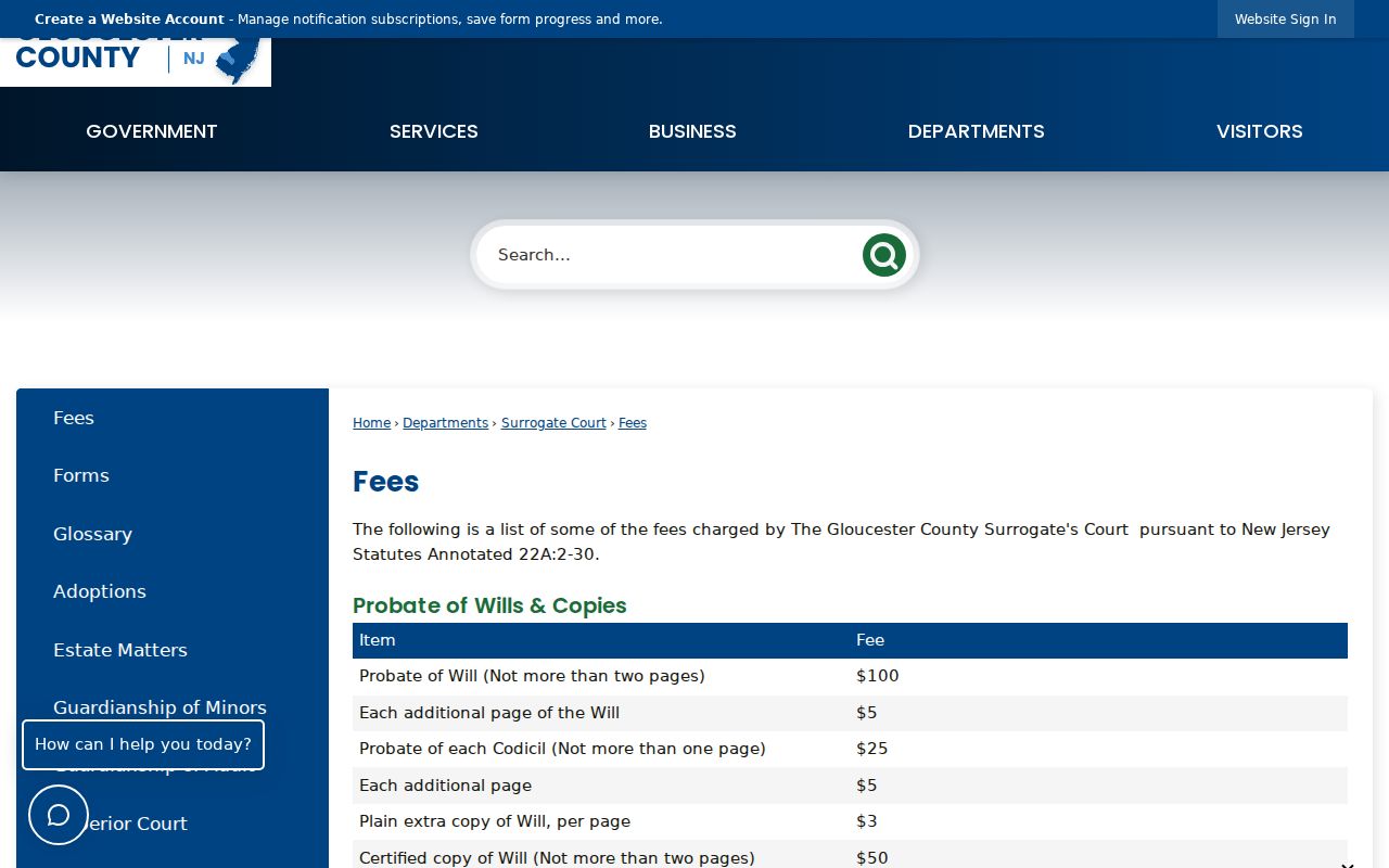
Fees and office procedures change. The research records a $10 estate-search fee and separate probate, plain-copy, and certified-copy fees, but a current request should use the official fee schedule and the Surrogate's instructions. These are Surrogate fees, not OPRA copying charges.
Gloucester County Previous Residents Need Dated Evidence
Each record should retain its own date, custodian, geography, and limit. A deed proves a recorded conveyance, not occupancy. A parcel record can show an owner or tax mailing field, not everyone at the situs. A city directory documents a printed listing in its edition, and a map labels a place at its own date. This discipline is vital in Gloucester County because Gloucester City and Gloucester Township are in Camden County, while older directory titles may use a broader Gloucester label.
For a gap before the computer index, specify the series and date span instead of asking for generic old records. The Record Room and GCHS hold separate material, and staff can help locate a record without conducting an unlimited title or genealogical search. A reliable past-resident conclusion is a chain of cited records, with uncertainty left in place where the records do not resolve it.